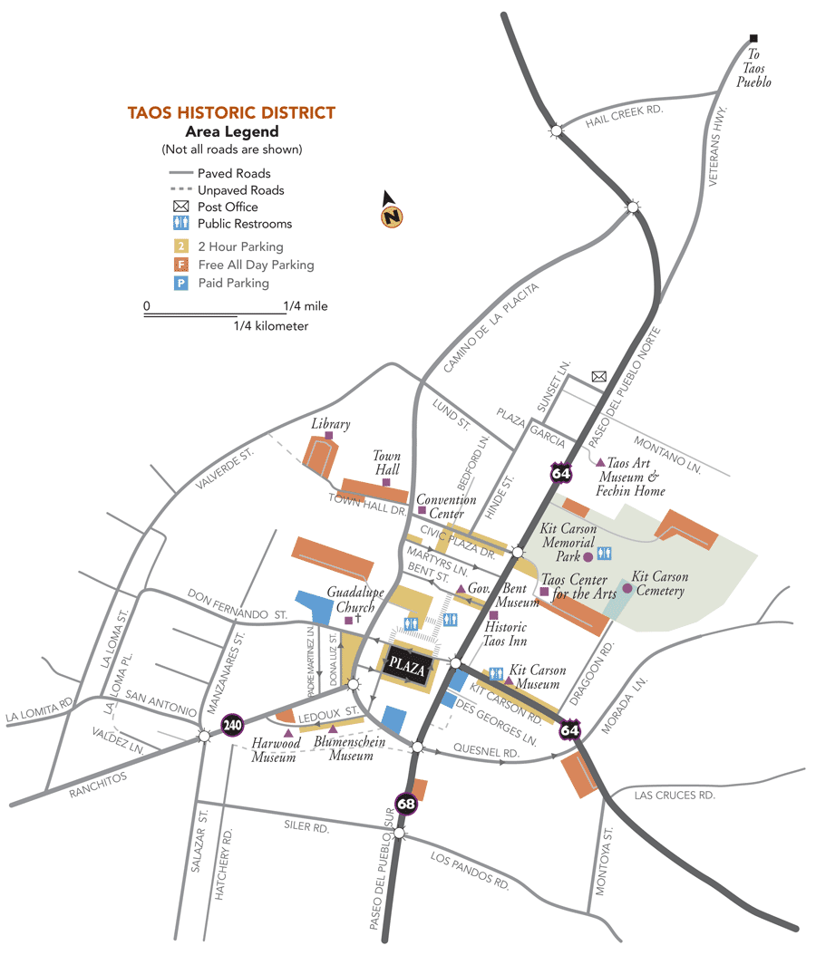
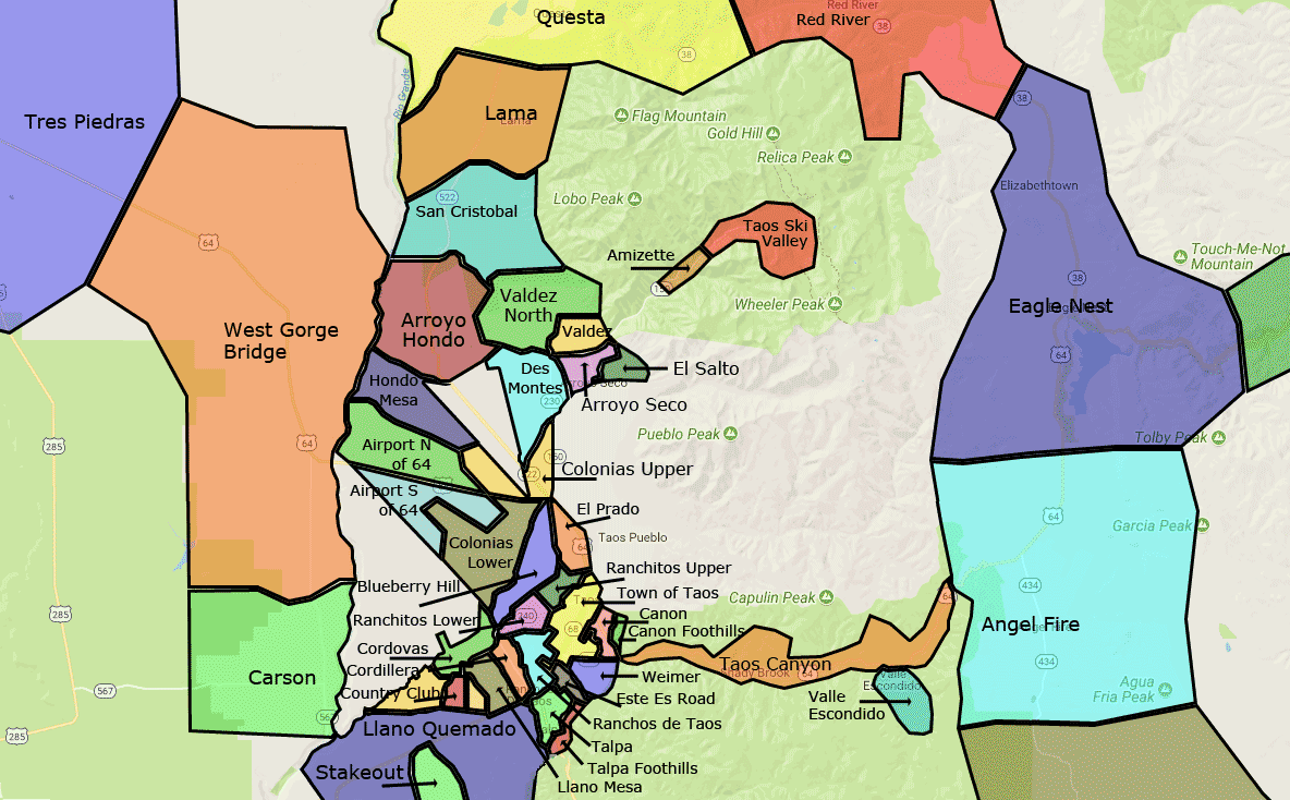
Taos Neighborhood Map
Taos is a collection of neighborhoods and many unincorporated areas around Taos have distinctive names that represent the ancient traditions of naming a place for a stream or topographic feature. Arroyo Hondo, Arroyo Seco and El Prado are all such places. These are not towns and have no political jurisdiction, they are simply places that help folks zero in on a very specific neighborhood. Within Taos itself are many such neighborhoods that may comprise no more than a few “blocks.”
The greater Taos area is made up of several unincorporated areas and neighborhoods that separates out as if they were their own destinations or towns. Below are a few maps that will help you navigate the various areas.
Taos Neighborhood Map Large PDF »
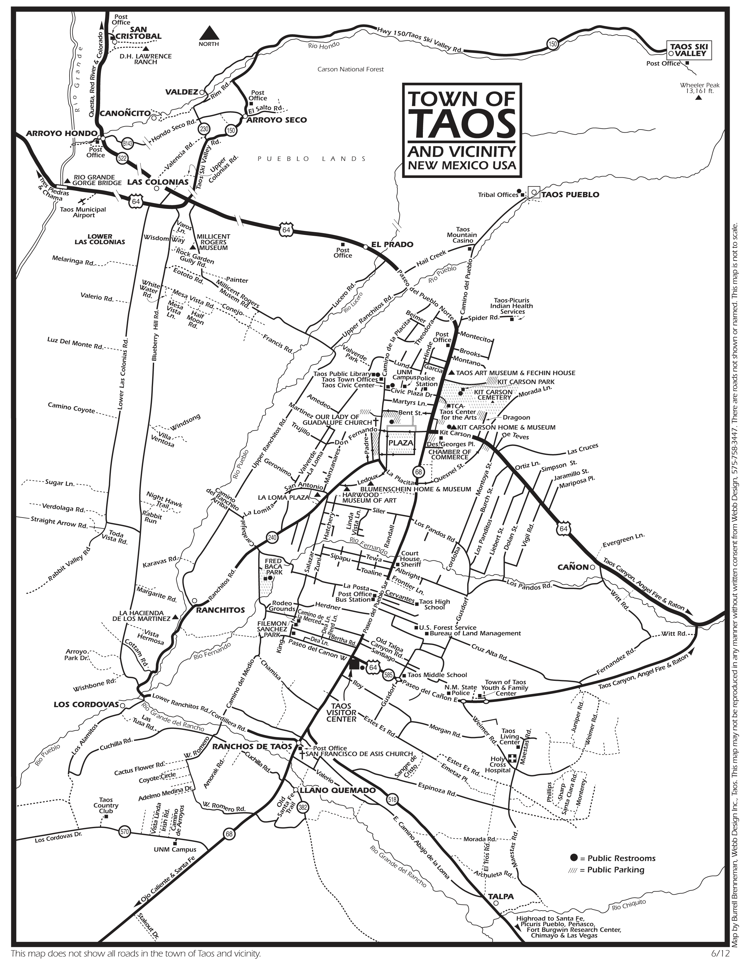
Taos Street Map
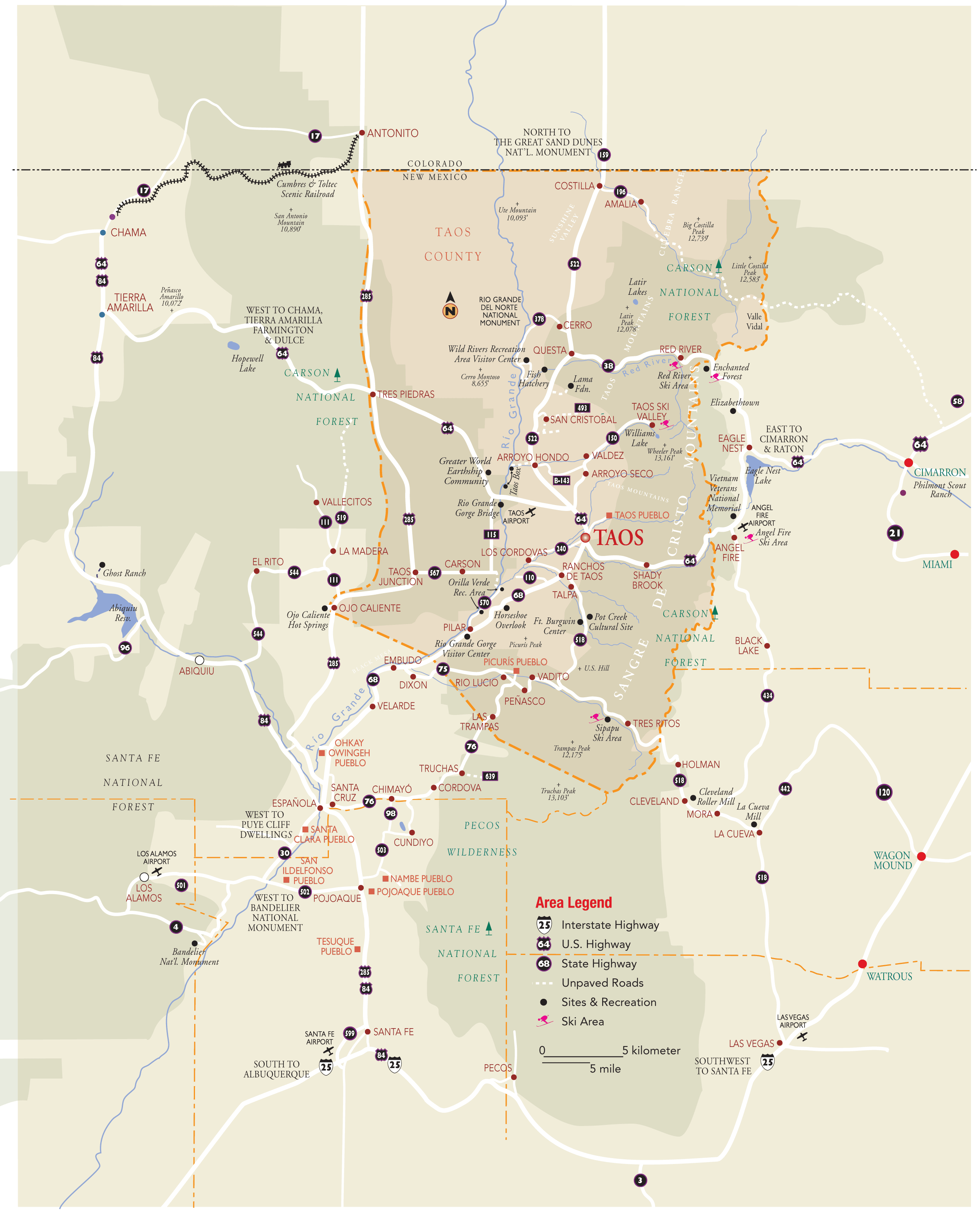
Taos County Map
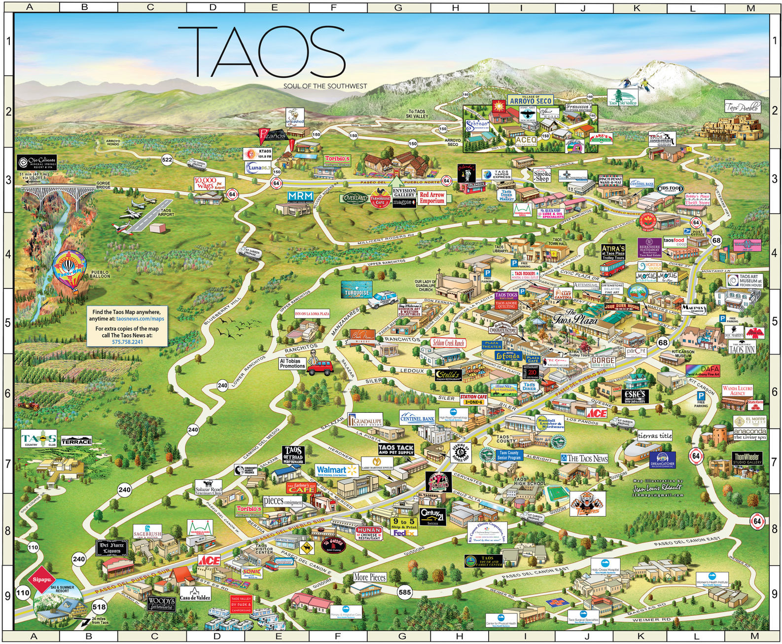
Taos Illustrated Map
Taos Illustrated Map 2017 PDF »
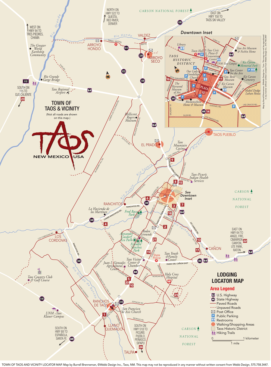
Taos Lodging Map